HOW DO THE SOCIAL NETWORKS OF THE PUBLIC ORGANISATIONS WMO-RADAR, BUURTSTEUNPUNT AND PAMEIJER CONNECT TO AND ENCOUNTER IN THE PUBLIC DOMAIN?
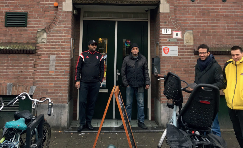
Tussendijken en Bospolder is a neighborhood with substantial multicultural community and location near the city center, good access to the Rotterdam Ring, schools, facilities, and Historic Delfshaven just around the corner. Nevertheless, due to the different groups living in the area the location has a lot of social challenges in the connecting and socializing level. Neighborhood care centres play a big role in connecting the different inhabitants of the neighborhood. They are a key player in establishing social development. Wmo-radar is the main contractor with the municipality and therefore important in the neighborhood. In this chapter, next to wmo radar, we also research two other organisations that are active in the BoTu neighborhood, Buurtsteunpunt and Pameijer.
Research method
In this research, we worked on collecting quantitative and qualitative data about the research area and the three organisations. The quantitative research is mainly used to get a better understanding about the neighborhood to give a direction of asking useful questions in the qualitative research. The quantitative is gathered by doing interviews. This information helps us to understand the main picture of the research area and to address the challenges. The qualitative information will ensure to get closer to these challenges and build a better and specific image about the area and the organisations.
The three organizations
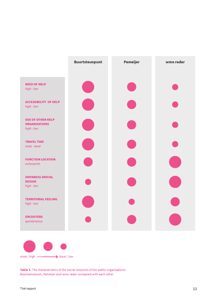
All three organizations address different social networks. The need of help of the social networks is connected to the location, spatial design and the encounters of the different organisations. At Buurtsteunpunt the need of help is the highest, which results in the high accessibility of help and a high travel time. Another reason for the higher travel time of both Buurtsteunpunt and Pameijer is that they often get known with the organisation via contacts. There is a high sense of territorial feeling at Buurtsteunpunt, that is connected to the closeness of spatial design and also with their high need of help. The participants of Pameijer are also in a high need of help, but a little less than the participants of Buurtsteunpunt. The spatial design of Pameijer is more open which could also result in more spontaneous encounters than at Buurtsteunpunt. The location of Wmo-radar is central in Bospolder-Tussendijken and it has the most open spatial design. These characteristics are connected to the low travel time and the spontaneous encounters.
Comparison social care organizations
Collaboration care centres in BoTu and surrounding neighborhoods got more active due to the Covid-19 outbreak.
Use of public domain
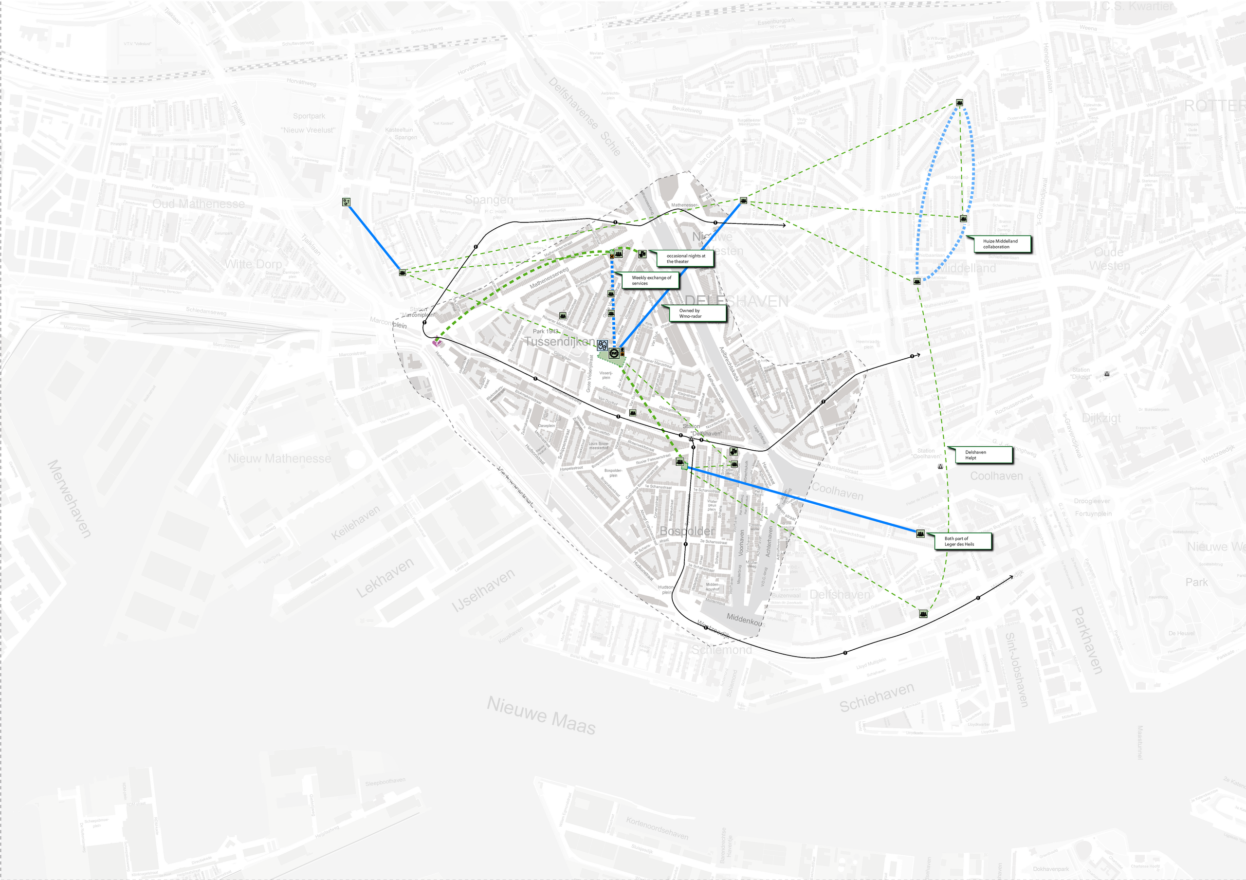
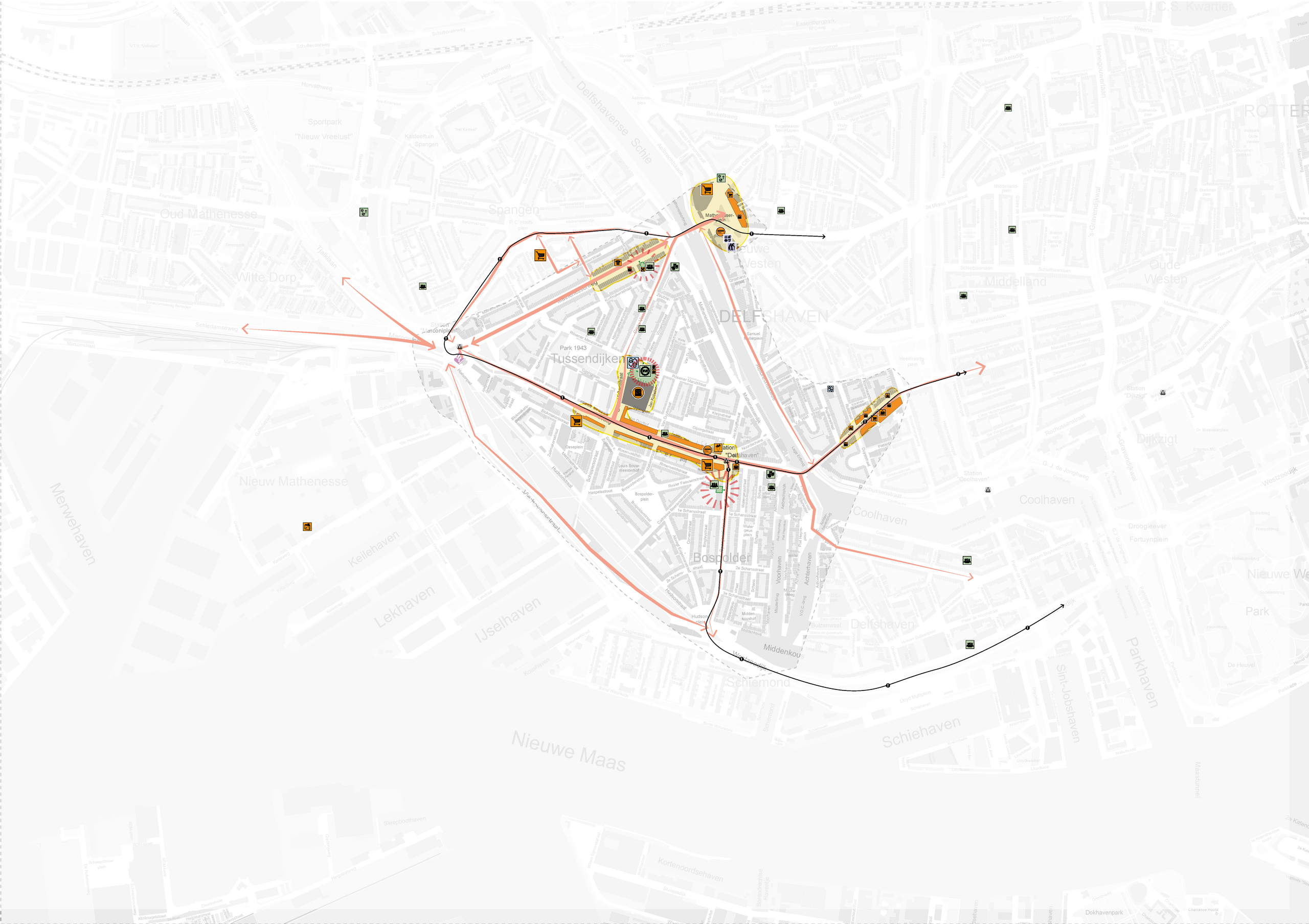
The different social networks largely all use the same functions in Bospolder-Tussendijken for their daily needs. However, there are small differences: the social network of Buurtsteunpunt uses functions all over Rotterdam to fulfil their needs, where the visitors of wmo radar and Pameijer are more focused on Bospolder-Tussendijken in their daily life. The use of the public domain of the social networks of the three organizations is translated to the anchor point map. The anchor point in the research output section shows four different anchor points where the social networks of wmo radar, Buurtsteunpunt and Pameijer connect to and encounter in the public. This research relates to the overarching theme at aspects of the spontaneous and nonspontaneous encounters of the social networks at Buurtsteunpunt, Pameijer and wmo radar. At wmo radar the encounters are the most spontaneous, followed up by Pameijer. Buurtsteunpunt has the most unspontaneous encounters.